Routing Preferences can be set when creating a Route Profile or as Route Options when running a specific route.
(Click on the headings below for more details.)
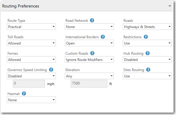
Toll Roads
Select Allowed to use toll roads on routes, or Discouraged to only use a toll road where necessary to avoid long, impractical detours. Default value is Allowed.
Ferries
Select Allowed to use ferries on routes, or Discouraged to only route on a ferry where necessary to avoid long, impractical detours. Default value is Allowed.
Governor Speed Limiting
Select Enabled to use a maximum road speed in route calculations, then enter a custom value or use the 55 mph default. This speed overrides all other speed values for a trip when those speeds are higher than the governor setting and directly affects a trip's travel time and ETA calculation.
The use of a governor speed limit can help you more accurately calculate drive times and ETAs in PC*MILER, publish ETAs from PC*MILER to customers with more confidence, and calculate a more accurate HOS-planned route if desired. By default, governor speed limiting is Disabled.
Hazmat
(Visible only if the Hazmat add-on is licensed and installed.) Learn more about PC*MILER hazmat route types and road categories. The default route type is None.
Road Network
(U.S. only) Select State + National Network to favor the U.S. Federally designated National Network (primary Interstates with reasonable entry/egress points up to 1 mile off the Interstate) and state-designated extensions to the National Network (additional highways and supporting roads any distance off the Interstate, as determined by individual states). This option will calculate routes that stay on the National Network to the maximum extent possible. The default value is None.
International Borders
Select Closed to minimize the number of international border crossings. For example, if all your stops are in the “lower 48” United States, the resulting route will stay in the United States even though the most practical or shortest route would normally involve some Canadian mileage. The Open option ignores international boundaries in generating the best route. Borders are open by default.
Custom Roads
Select Use Route Modifiers to apply all user-designated avoid/favor road preferences to route calculations, including geofences, truck restriction overrides, and hazmat permit overrides. User-designated road preferences won’t be used unless this option is selected. Does not affect via points or routes that have been dragged onto another road on the map.
Elevation
Select Discourage Above and then enter an elevation in feet to set a customized limit on the elevation of the roads a route will use. Elevations at or above this height will be avoided on a route unless 1) it is extremely impractical to do so; or 2) a stop or destination on the route is located at the higher elevation. No warnings are issued when a road that exceeds the elevation limit must be used.
Roads
(The Streets add-on is required for street-level routing) The Highway Only option is selected by default except when the Streets or Energy add-ons are licensed and installed. The Highway Only option calculates routes using an air distance from the midpoint of the truck-usable highway segment that is nearest to the destination postal code or city/state. Routes to stops that include a street-level address are calculated to the truck-usable highway-level road that is closest to the entered address. This functionality matches the base PC*MILER highway product.
When Highways & Streets is selected, PC*MILER calculates the route and driving distance using local streets between the nearest truck-usable highway segment and the stop. All stops, whether they contain a street-level address or not, clean up via the shortest air distance to the nearest road (highway or street level). This distance may appear as “Local” in the Detailed Route report.
Restrictions
Select Override to generate routes that waive truck restrictions pertaining to specific sizes and weights, but that continue to avoid truck-prohibited and truck discouraged roads. When this option is active, height, length, width and weight restrictions will be overridden. If a route uses roads that have any of these types of restrictions, the Detailed Route Report will list them. This allows you to determine the largest or heaviest vehicle you can assign to drive that route.
When Use is selected, PC*MILER routing will avoid truck-prohibited and truck-discouraged roads, as well as truck-restricted roads that pertain to the size and weight set in the current vehicle dimensions or profile.
For Streets add-on users, an error message will appear if you attempt to enter an address that is on a truck-prohibited road.
Hub Routing
Select Enabled to generate mileage from one origin defined as the "hub" to an unlimited number of destinations in the same route window. This type of route calculation gets its name from the image of a wheel with spokes and a hub at the center. The Detailed Route Report and State/Country Report are both available for hub routing. Note that timestamps won’t be shown along a hub route on the map. By default, hub routing is Disabled.
Sites Routing
Disable to ignore Site information, such as entry and exit gates, when calculating distances, travel times and driving directions. A Site extends a location from just a name and address to include a boundary polygon around its perimeter, entry and exit points (gates), and other valuable information. For example, a Site could be a warehouse, a shopping mall, a distribution center, a yard, a business park, and more.
Sites are created in Content Tools and shared with PC*MILER for use in route planning. Routing to a Site can provide more accurate directions and time and distance estimates, as well as other details a driver needs to avoid getting lost, feeling stressed or wasting time.
