(Applies only in countries for which Streets address data has been purchased. The street-level map data set must be selected.)
If the Streets add-on is purchased and installed with PC*MILER, you can—optionally—specify a street-level address for a stop. Enter a street name by itself or with an address number in the Address field below the city entry.
Addresses can be added to a city/state or postal code entry. An address can also be combined with a latitude/longitude point for more precise geocoding.
To turn on local street routing
In the route window select the gear button > Route Options > Routing Preferences > Roads > Highway & Streets.
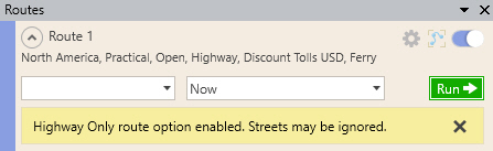
If you enter an address when the Highway Only mode is enabled, a warning will appear above the stop list. To delete the warning, click the “X” on the far right.
TIP: To see an address range on the map, place your cursor over any road segment—a tooltip with the street name and address range of that segment will pop up.
TIP: If you enter a ZIP/postal code and PC*MILER can’t find an address that you specify within that code, try expanding your search by entering the city name. In general it is recommended that, when entering or importing addresses, you use the corresponding city/state instead of the location’s postal code. (For example, enter “457 North Harrison Street, Princeton, NJ” rather than “457 North Harrison Street, 08540”.) Using the city and state/province will increase the geocoding match success rate and provide a more accurate representation of the address when routing.
