To display weather data on the map, select the Map tab > Weather > and check one or more options (Radar Layer, Cloud Layer, Road Conditions Layer, or Weather Alerts). You will immediately see the data you selected being drawn on the map.
• Radar Layer: Displays current precipitation events using a gradation of colors that indicate rain and snow. This data does not contribute to the generation of alerts. It is a visual aid only.
• Cloud Layer: Displays current patterns of precipitation (cloud formations) as they are received from AerisWeather. This data does not contribute to the generation of alerts. It is a visual aid only.
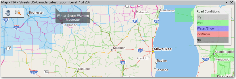
• Road Conditions Layer: Displays current road conditions as well as road conditions up to 24 hours in advance. Road conditions are informational only and are not used in route calculation.
• Weather Alerts: Displays colored polygons showing areas where a predicted weather alert has been issued by the U.S. National Weather Service or Environment Canada.
Radar and Cloud Layer

Road Conditions
The Road Conditions overlay can display current road conditions, which are designated as dry, wet, water/snow and ice/snow.
Weather Alerts
To see an Alerts legend on the map, select the Map tab > Legends and check Weather Alerts. To see a descriptive tooltip for an alert zone, place your cursor over a colored polygon on the map.
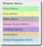
Weather alerts legend
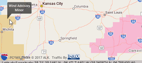
Tooltip alert description on a map
